
05/04/2023

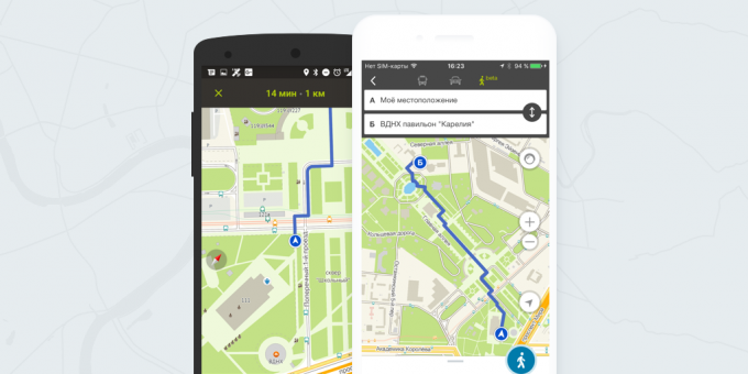
Now, in "2GIS" You can see how to get to your destination on foot. The route is laid in view of paths, stairways, arches and pedestrian crossings.
"2GIS" project to date is one of the few Google Maps competitors. His information about roads, facilities and transport routes, sometimes even more complete than the search giant. And now, in mobile applications and on "2GIS" Online there is also an opportunity to lay hiking trails.
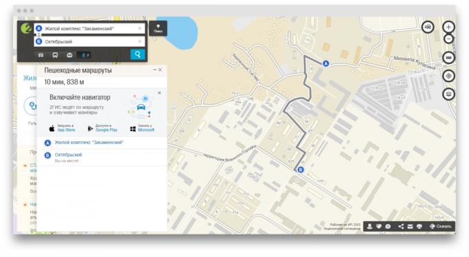
In order to pave the walking route, you must set the start and end point, and then press the button with the little man. The program will calculate the best route, the distance to the end point and the approximate time it takes to achieve it.
Calculation of a walking route is made in view of paths, walkways, tunnels, stairways, arches, and even the presence of pedestrian crossings. you can instantly switch to the car or the bus route and evaluate how to get to the desired point of the fastest, if desired.
This feature is still in development, so an application can only plot a route. After a while, the developers promise to implement automatic updating your routes and decrease along the way.
Walking routes are available now in 20 Russian cities, including Moscow, St. Petersburg and Novosibirsk. You can start using this function right now Online "2GIS" or in mobile applications for iOS and Android (only in beta).

Price: Free